
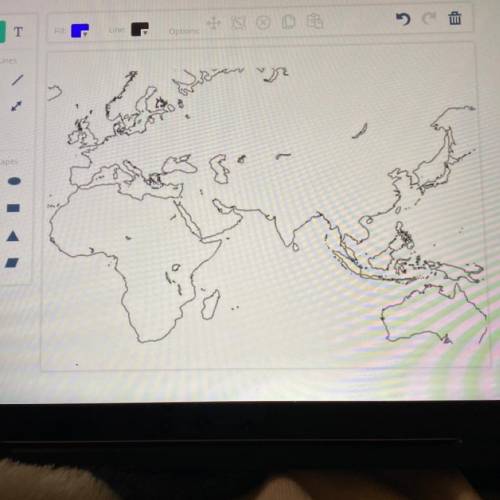
In this part of the activity, you will plot elements in the drawing field to create your map of the
trade routes used during the time of the Roman Empire. Alternatively, print out this baseline map
. draw the elements by hand, and turn in the completed map to your teacher
Begin by drawing these elements on the base map:
. a key or legend that tells your audience what each symbol, shape, or color on your map
represents (for example, your key may show that a red region indicates the Indian
civilization)
• a compass rose, a figure that shows the main directions on your map (north, south, east, and
west)
• important geographical features, such as mountains and rivers, along with their names (for
example, you may indicate the indus River with a blue line)
• colors to indicate the three main trading regions--the Roman Empire; the Asian civilizations
of India, China, and Persia; and the African civilizations of Axum and Kush
Next research the trade routes that were in use between the Roman Empire and the civilizations
of Africa and Asia. Then draw the major trade routes on the map. Make sure that you plot trade
routes that include these regions and cities:
• Roman Empire
• Egypt
• Persia
• Arabia
• India
• Meroe (city in the Kush kingdom)
• Adulis (city in the Axum kingdom)
Mediterranean Sea and the Indian Ocean

Answers: 2


Another question on History
History, 22.06.2019 01:50
Why was the nationalist party more popular in china’s cities than in the countryside?
Answers: 3
History, 22.06.2019 04:30
Examine this list of events that took place in china during the 20th century. which event or events could possibly have been a cause of the great leap forward? a. i only b. i, iii, and iv c. i and iii d. iii and iv
Answers: 1
History, 22.06.2019 05:00
Plz which of the following statements about life in europe during the middle ages is not accurate. a. by the middle ages the only unifying factor in europe was christianity. b. most people lived in rural areas and worked on farms. c. priest, monks and church officials were virtually the only people in europe who could read and write d. most people lived in cities or towns and worked as skilled artis most people lived in cities or towns and worked as skilled artisans.
Answers: 1
History, 22.06.2019 06:30
How was hitler able to take control of czechoslovakia? ? a) czechoslovakia was forced to break its alliance with france & the soviet union to appease hitler b) without resistance, he extended his control of the sudetenland to include all of czechoslovakia c) the czechs reluctantly agreed to provide “lebensrum, or living space to the germans d) he was given czechoslovakia by great britain and france in keeping with the policy of containment. appreciate the
Answers: 2
You know the right answer?
In this part of the activity, you will plot elements in the drawing field to create your map of the...
Questions


Mathematics, 04.09.2021 05:10
Mathematics, 04.09.2021 05:10
Mathematics, 04.09.2021 05:10

Social Studies, 04.09.2021 05:10

Mathematics, 04.09.2021 05:10

Spanish, 04.09.2021 05:10
Mathematics, 04.09.2021 05:10
Mathematics, 04.09.2021 05:10

Mathematics, 04.09.2021 05:10


