Geography, 12.07.2019 07:30 Lkirjnnfcxd5039
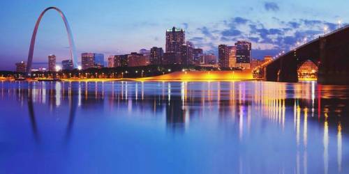
In which of the following states is the gateway to the west located? missouri arkansas iowa kansas

Answers: 2


Another question on Geography

Geography, 24.06.2019 02:00
What can happen to solar radiation when it enters earth’s atmosphere? check all that apply. it is absorbed by earth. it is reflected by clouds. it is reflected by glacial ice. it is condensed into visible light. it is amplified by water molecules.
Answers: 2

Geography, 24.06.2019 20:50
What change took place in china's southwest region after the communists came to power? a) encouraged by government policies, the economic base of the region changed from agriculture to nòmadic herding. b) the communist government established a special economic zone in the region. c) the leader of the religion practiced in the region went into exile, d) the leader of the religion practiced in the region was executed.
Answers: 2

Geography, 25.06.2019 11:00
Aphysical map of antarctica is shown, with color-coded elevations. green represents 0 to 649 ft (1 to 199 m), light green represents 650 to1649 ft (200 to 499 m), yellow represents 1650 to 3249 ft (500 to 999 m), light orange represents 3250 to 6549 ft (1000 to 1999 m), and dark orange represents 6550 ft (2000 m). dark orange and light orange shades most of the surface area of antarctica, with green and yellow along the borders of the west antarctic peninsula. longitude lines are shown converging in a spherical pattern around the continent, with 90 degrees w and 90 degrees e cutting through the mainland horizontally, and the international dateline (0 degrees and 180 degrees) cutting through vertically. clockwise from 0 degrees, 30 degrees e, 60 degrees e, 90 degrees e, 120 degrees e, 150 degrees e, 180 degrees e, 150 degrees w, 120 degrees w, 90 degrees w, 60 degrees w, and 30 degrees w are shown. latitude lines are also shown encircling the continent. 50 degrees s and 60 degrees s outside of the mainland, 70 degrees s on the outer edge of the continent, and 80 degrees s in the interior part of the continent. off the coast of western antarctica, a large permanent ice pack is labeled throughout portions of the bellingshausen, amundsen, ross, and weddell seas, between the coordinates 60 to 70 degrees s and 30 degrees w and 150 degrees w. all waters directly off the coast of the continent are labeled as permanent ice packs. the ross ice shelf is shown in the bay between the western and eastern portions of the continent, at approximately 160 degrees w, 80 degrees s. the ronne ice shelf is shown near the northwestern coast, at approximately 60 degrees w and 80 degrees s. © 2012 the exploration company at which of these coordinates can the indian ocean be found? 60° s latitude; 60° e longitude 70° s latitude; 60°e longitude 0° latitude; 90° w longitude 80° s latitude; 90° w longitude
Answers: 2

Geography, 25.06.2019 20:00
Since ireland was granted total independence in 1949, northern ireland has been struck by violence that arose from conflict over what issue? a. whether to reunify with the rest of ireland b. weather to switch to the euro c. how to respond to the famine d. how best to change the economy
Answers: 1
You know the right answer?
In which of the following states is the gateway to the west located? missouri arkansas iowa kansas...
Questions

Mathematics, 13.02.2020 08:02

Health, 13.02.2020 08:02


Mathematics, 13.02.2020 08:02

Mathematics, 13.02.2020 08:02

Engineering, 13.02.2020 08:02

Mathematics, 13.02.2020 08:02

Mathematics, 13.02.2020 08:02


Mathematics, 13.02.2020 08:03

History, 13.02.2020 08:03

Physics, 13.02.2020 08:03

Mathematics, 13.02.2020 08:03


English, 13.02.2020 08:03


Mathematics, 13.02.2020 08:03


